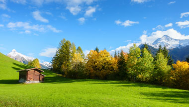
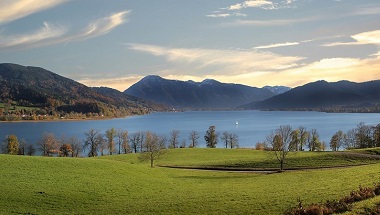
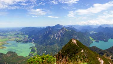
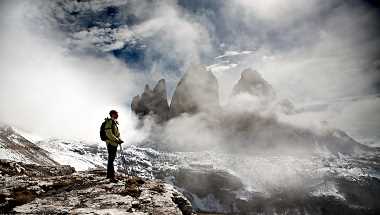
- Home
- Trans-Alpine Crossing Munich Venice
- Lake Constance to Lake Königssee - Classic Tour
- Isar Cycle Route
- Munich - Lake Garda
- Allgäu Cycle Loop
- From Salzburg to Grado by E-bike
- The river Ammer-Amper cycling trail
- Munich Lakes West Tour Classic
- Kitzbühel - Three Peaks
- KAT-Walk
- Mystery moors, lakes and mountains
- From Lake Tegernsee to Kitzbühel
- Trans-Alpine Crossing from Tegernsee to Vipiteno
- SalzAlpenSteig I
- Bavarian Alps & Lakes
- From Lake Garda to Venice
- From Cortina to Venice
- Service
- About us

Salt Trail from Chiemsee to Königssee
hiking trip - Fire and Ice Own Tour
Discover 125 km/78 mi of the first part of the SalzAlpenSteig (English: “Salt Alps Trail”) from beautiful Lake Chiemsee to the picturesque Lake Königssee not only incredible and unique landscapes, but learn more about the salt springs, the salt deposits as well as about the history of the salt production and distribution. Expect to be overwhelmed by the amazing panoramic views, the characteristic Lake Chiemsee and Lake Königssee and be prepared to experience many regional traditions.
| 01. DAY |
| Arrival Individual Arrival in Chiemsee region |
02. DAY
|
| Bernau/Prien - Marquartstein The transfer brings you to Prien am Chiemsee in the morning and start your first stage. The hike takes you through the villages of Prien and Bernau with great views of the mountains. This stage takes you through moorland forests, moorland landscapes over the forests above Bernau and Rottau until you finally reach Kucheln and then Grassau and Marquartstein straight away. Overnight stay in Marquartstein. |
03. DAY
|
| Marquartstein - Ruhpolding After breakfast, a transfer takes you to Bergen. There you take the cable car to the top of the Hochfelln, the panoramic terrace of the Chiemgau. On the approximately 20-minute ride, you will already get a first taste of what awaits us on this hike: a magnificent distant view of the surrounding mountain ranges, towns and countryside and a wonderful hike in the alpine landscape of the Hochfelln. The trail leads you through mountain pines, across large alpine meadows and through sparse forests steadily down the mountain. You pass the idyllically situated Felln-Alm and later hike past the Farnbö... weiterlesenden-Alm. As you continue, you will walk around the Reitstein (1250m). A little later you reach the magical fairytale forest near Brand, which is an impressive experience with its many caves and grottos, not only for the younger hikers. Always follow the signs to Ruhpolding, todays stage destination. |
04. DAY
|
| Ruhpolding - Inzell On the third stage of the SalzAlpenSteig, an eventful hike awaits you between Ruhpolding and Inzell in the Chiemgau Alps. At the foot of the Rauschberg (1645m) you will reach the picturesquely situated Taubensee lake, hike on wonderful paths through the montane forests to the Fahrriesboden chapel and on to Schmelz, from where it is only a stones throw to your stage destination Inzell. |
05. DAY
|
| Inzell - Bad Reichenhall This varied, but also strenuous stage leads you, starting from the climatic health resort of Inzell, across moorland and lush meadows to the Weißbach Falls. Along the Weißbach and the Weißbachschlucht gorge you come to the Thumsee and over the Bürgermeisterhöhe above Kirchberg to the centre of Bad Reichenhall. |
06. DAY
|
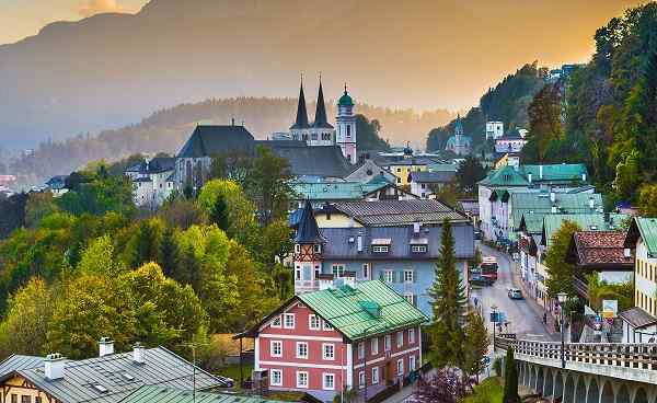
| Bad Reichenhall - Bischofswiesen Todays 16 km long stage offers you a lot of information and sights on the topic of salt, a very varied landscape and beautiful views of the Alps. Visit the Old Salt Works in Bad Reichenhall, the Town Pulpit from where you have a magnificent view of the Alpine spa town, as well as the idyllic community of Bayerisch Gmain. Brine pipes and other -salty- sights make the trail an entertaining experience for the whole family. Continue hiking until you finally arrive in Hallthurm. The old house of Hallthurm there is part of the former fortifications of the prince-provostry of Berchtesgaden against Sa... weiterlesenlzburg and Bavaria and was built in 1194, on the occasion of an attack by the citizens of Reichenhall in 1193 (during which the salt brew pans of Berchtesgaden were destroyed). Continue slightly uphill through the forest, you will cross the Schwarzgraben and the Frechenbach and finally reach the Bischofswiesener Ache, whose course you follow to Winkl and our destination Bischofswiesen. Transfer to your hotel in Bad Reichenhall. |
07. DAY
|
| Bischofswiesen - Ramsau Transfer back to Bischofswiesen. From leisurely paths along rivers and streams to steep ascents, e.g. to the Mordaualm, this stage of the SalzAlpenSteig in Berchtesgadener Land has everything to make a hikers heart beat faster. |
08. DAY
|
| Ramsau - Königssee The eventful seventh stage of the SalzAlpenSteig from Ramsau to Berchtesgaden begins with a short hike along the northern bank of the Ramsauer Achen. At the foot of Geröllberg (1162m) and Söldenköpfl (1022m), you follow the old brine pipes in the direction of Engedey and are repeatedly rewarded for the efforts of the ascent with magnificent views in the bird sanctuary above Ramsau. The view here wanders south over Ramsau to the Hochkalter (2606m), the northernmost blue ice glacier in the Alps and one of the highest mountains in Germany, the Mittelspitze (2713m) and the Kleiner Watzmann (230... weiterlesen7m). From Engedey you start the ascent to the Grünstein, a well-known panoramic mountain in the Berchtesgaden Alps, which can also be climbed via several via ferratas. On forest roads and forest paths, you will go uphill in serpentines to the Grünsteinhütte, from where you will once again have a great view of the Berchtesgadener Land. Along the Weißen Wend, you hike down into the valley and reach Schönau after this varied hike. This stage ends here with a wonderful view over the Königssee. Overnight stay in Berchtesgaden or Schönau. |
| 09. DAY |
| Departure Individual Departure |
Booking code: SALZ-ALPEN-M-GEPAECK-EN
| Season | Category | Single room | Double room p.P. |
| 01.07.2024 - 31.08.2024 (start day: Sat, Sun) | Standard | 1.369 EUR | 1.069 EUR |
| 01.09.2024 - 28.09.2024 (start day: Sat, Sun) | Standard | 1.339 EUR | 1.039 EUR |
All prices per person in EURO
Minimum number of participants: 4 people per date
Minimum number of participants: 4 people per date
Services Included
- done Individual long distance hiking (no group travel)
- done 8 nights in selected 3*** hotels or inns
- done Daily breakfast, rooms with Shower /WC or bath
- done luggage transfer from hotel to hotel
- done Optimally prepared route guidance
- done Digital travel documents per room
- done Transfer on the 3rd day from Grassau to Bergen
- done Ruhpoldinger eXtra card (obligatory)
- done Inzell-Card (mandatory)
- done Service Hotline
Services not included
- ×Arrival to and departure from tour
- ×Hiking equipment such as shoes, helmets etc.
- ×All local taxes payable on the spot
- ×Personal expenses and tips
- ×Optional sightseeing visits
- ×Transfer as long as not part of itinerary
- ×boards as long as not part of itinerary
Other notes
To ensure a stress-free start to the trip, we recommend arriving at the starting point by early evening in most cases. Some tours start as early as midday, in which case we recommend arriving the day before and will be happy to book an extra night for you at the same time. The individual return journey takes place on the last day of the tour. The distances are approximate and may differ from the actual distances covered. This tour is not suitable for people with reduced mobility.
Minimum number of participants
If a minimum number of participants is required for the tour to take place, this is stated under "Prices and services". If the minimum number of participants is not reached, we reserve the right to cancel the trip up to four weeks before the "arrival date". We recommend organizing the arrival and departure only after this deadline has passed.
7-day carefree number
No matter how well planned a trip is, in rare cases unexpected things happen. At such times, it is nice to have someone you can rely on locally. For this reason, you have a local contact person on our individual activity trips who will be happy to provide you with information and, as stated in the travel documents, can be contacted in an emergency.